National Road
The Historic National Road, the Nation’s first federally funded highway, was conceived by George Washington and brought forward during Jefferson’s presidency by his Secretary of the Treasury, Albert Gallatin. Construction began in 1811 on the first leg of the road and the National Road from Cumberland to Wheeling was completed in 1818.
As wealthy plantation owners, Lydia and Moses Shepherd ascended to the apex of early Wheeling society, counting many influential individuals, such as U.S. Senator Henry Clay, among their friends. The Shepherds’ friendship with Sen. Henry Clay helped to secure the routing of the National Road through Wheeling ensure that the new National Road passed directly by the couple's stone mansion, Shepherd Hall. To show their gratitude, the Shepherds commissioned a monument to Clay to be erected on their property, which subsequently became known as “Monument Place,” and is now home to the Osiris Shrine Temple.
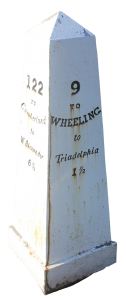
 Mile Markers
"Congress mandated that a stone marker be placed on the north side of every mile to tell travelers how many miles they were from Cumberland, MD, the starting point of the [National Road] ... As of 20[22], six such markers remain in the narrow northern panhandle of WV, which carries just 10 miles of the old highway." -Library of Congress
The painted cast iron markers were forged at John Snowden's foundry in Brownsville, Pennsylvania. National Register of Historic Places.
Location
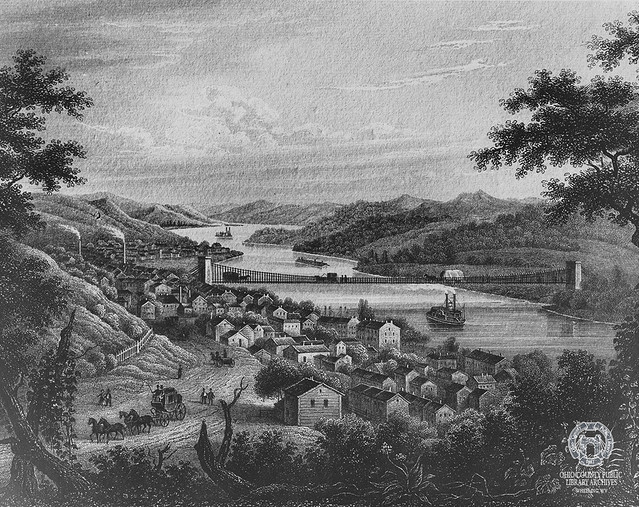
â–¶ The section of National Road that runs through West Virginia is approximately 16 miles long. National Road crosses into West Virginia near West Alexander, PA and runs parallel to Little Wheeling Creek, passing through Valley Grove and Triadelphia. At Elm Grove, it crosses Wheeling Creek and heads south toward Monument Place before crossing back over Wheeling Creek on the historic Elm Grove Stone Bridge built by the Shepherd. This is the only time the National Road crossing a body of water twice. The Road then runs parallel to Wheeling Creek, passing through Wheeling's Pleasant Valley, Edgwood, Woodsdale, and Fulton neighborhoods before climbing Wheeling Hill and entering the downtown area on Main St. through North Wheeling. The road crosses the Ohio River at 10th Street via the Wheeling Suspension Bridge, crosses Wheeling Island via Virginia St., connecting with Zane St. via S. York St., and over the back channel of the Ohio River into Bridgeport, OH via the route 250 bridge.
Newspaper Articles
â–¶ No newspaper articles at this time.
Photographs

Additional Resources
â–¶ View OCPL catalog results
Materials in the Wheeling Room:(non-circulating, ask for access at the reference desk)
â–¶ Vertical File: National Road, Wheeling Room, non-circulating, ask for access at the reference desk.

